The Glomma, is Norway’s longest and most voluminous river. With a total length of 621 kilometres (386 miles), it has a drainage basin that covers fully 13% of Norway’s surface area, all in the southern part of the country.
Continue reading Glommen [Glomma]Category: Maps & places
Places, buildings and travel routes
Hafslund
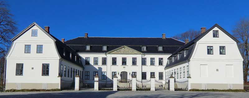
Hafslund is a borough located east of the city centre in the city of Sarpsborg, Norway,
Before 1992, Hafslund was a part of Skjeberg municipality. The name Hafslund, which is composed of Hafr, the Old Norse name for husband and lundr meaning grove. There has been a permanent settlement at Hafslund for over 5000 years.
Continue reading HafslundChristiania map & places of interest
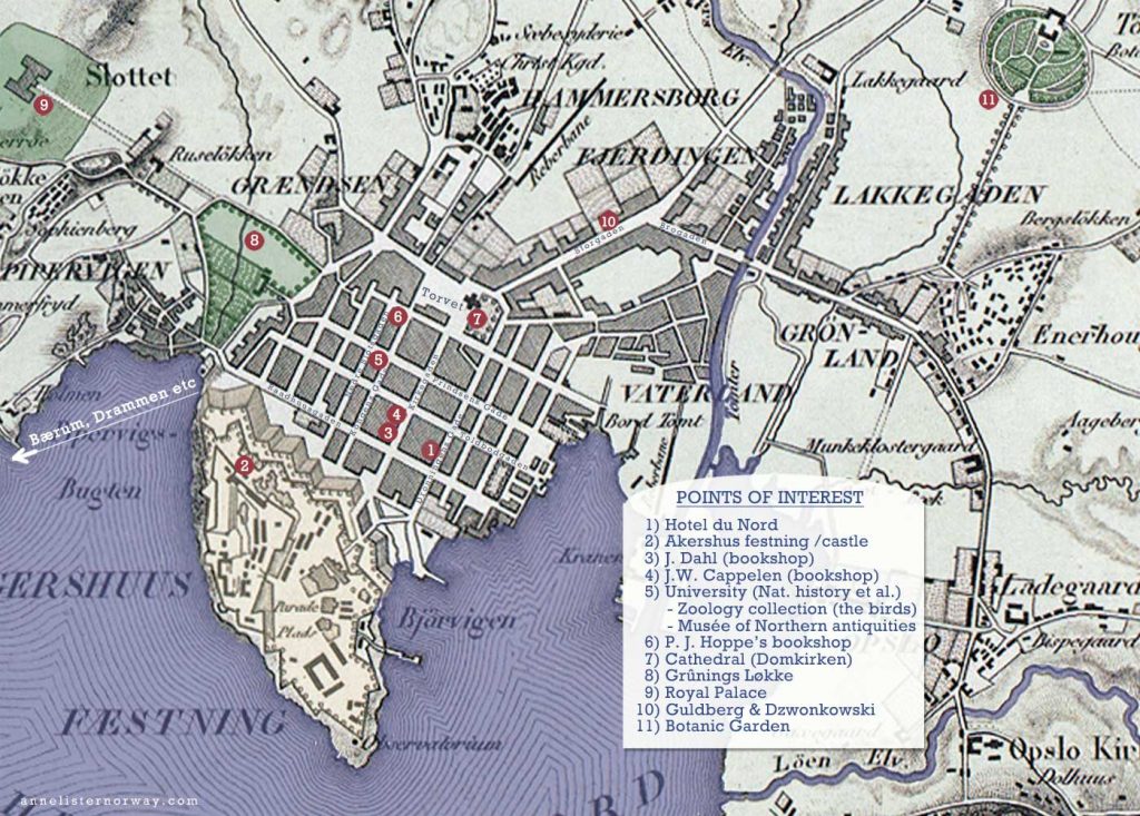
(Map from 1840 by unknown – edited by Y.Haugen)
Click for bigger version
1) Hotel du Nord (Anne and Ann’s hotel in Christiania)
2) Akershus festning /castle
3) J. Dahl (bookshop)
4) J.W. Cappelen (bookshop)
5) University (Nat. history et al.)
– Zoology collection (the birds) – “1 1/2 hour there seeing the birds”
– Musée of Northern antiquities
6) P. J. Hoppe’s bookshop – “Then to Hoppe’s for pencils English for Ann”
7) Cathedral (Domkirken)
8) Grûnings Løkke
9) Royal Palace
10) Guldberg & Dzwonkowski
11) Botanic Garden
Torvet, the Cathedral and Hoppe’s
Christiania Torv – the main square or market is just a couple of blocks from Hotel du Nord, where Anne and Ann stayed when in Christiania. The cathedral is situated at one end of the market, and Hoppe’s is right nearby. This market – now Stortorvet – is still there and a popular spot for buying blants, flowers and vegetables in summer.
Continue reading Torvet, the Cathedral and Hoppe’sDetailed maps Svinesund to Såner and older map showing Helle & Westgaard
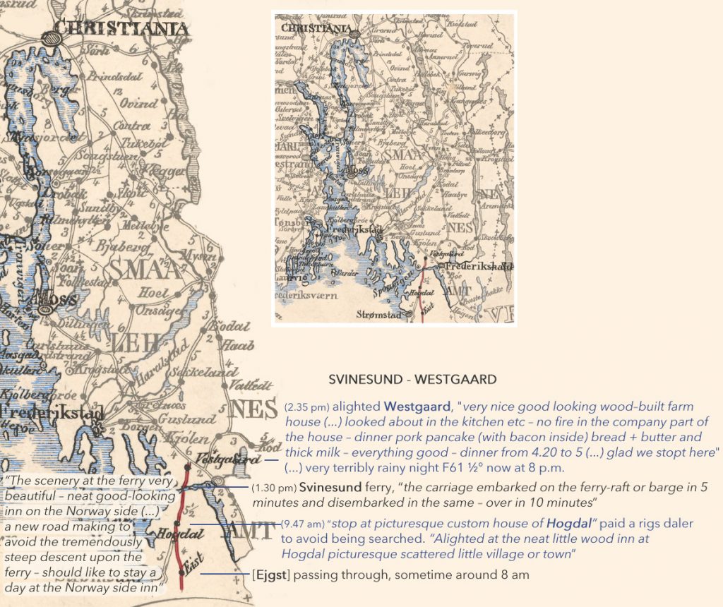
Svinesund to Soner (Smaalehnenes Amt)
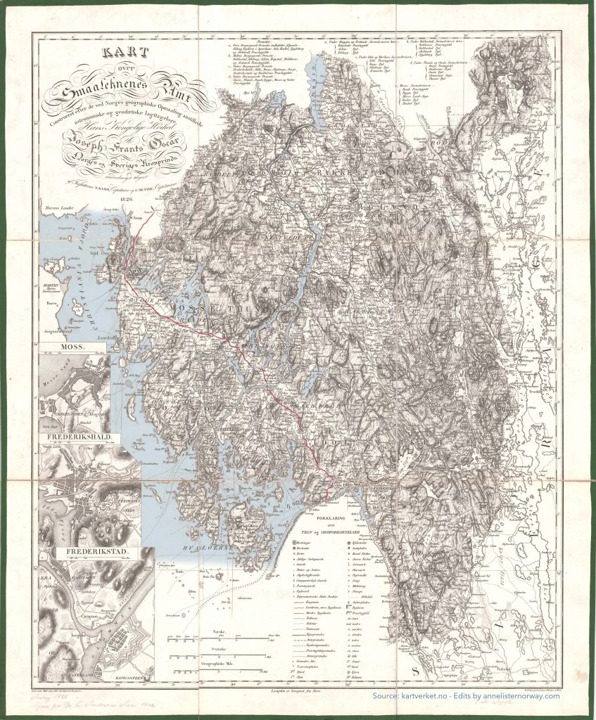
Kart over Smaalehnenes Amt – N. Ramm og G. Munthe (1826)
(Source: Kartverket / Edits and colors: Y.Haugen 2020)
Klick for large scale version of the map
Travel route day 2, 29. July
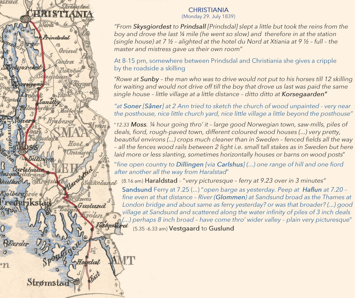
Travel route day one 28. July 1839
Svinesund and Søylegården (the Norway side Inn)
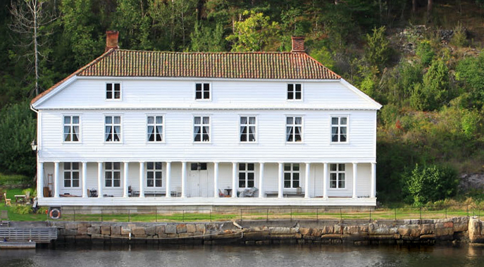
The inn Anne admires on entrering Norway, Søylegården, is said to have been set up in 1726; In 1830 the building was expanded with the west wing, second floor and “half-pitched” roof . The old east wing was expanded in 1840, and stands like that to this very day.
Continue reading Svinesund and Søylegården (the Norway side Inn)Såner kirke
“– at Soner [Såner] at 2 Ann tried to sketch the church of wood unpainted”
(- Travel notes 29. July 1839)
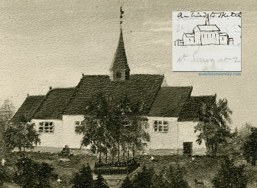
Inset is Anne Lister’s quick sketch done in her journal.
This church was built in the 1500s as a simple square church, and got the extentions that can be seen in this painting (owned by Rasmus Thorne) added in the 1700s. The old church had to be torn down in 1879 and it’s replacement opened in 1881
Korsegården
Korsegården used to be situated atwhat is currently a highway crossing, “the Korsegård-crossing” or Korsegårdskrysset, by the E6 in Ås, Akershus.
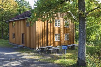
After the railroad arrived in the area in 1879, the building has been in use as a brewery, woodshop and homeless shelter. When the new highway was built, the house was moved to Follo Museum in Drøbak.
For hundreds of years this has been an important crossroads, the road between Oslo and Gothenburg (E6) crossing the road between Drøbak and Stockholm (E18). This was where the ancient road (oldtidsveien) went, then the Fredrikhald Kingsroad and Riksvei 1. The house can be dated back to 1725 as an inn and coach house. It has a history of drunken brawls and violence. In 1825 the inn keeper Niels Mortensen Korsegaarden killed his wife Anne Maria in a brutal way, chasing her around the house til she ended up dead in the upstairs “blue room”. Niels was sentenced to death and to have his head cut off and places on a pole, but was later pardoned to slave labour and eventually released.